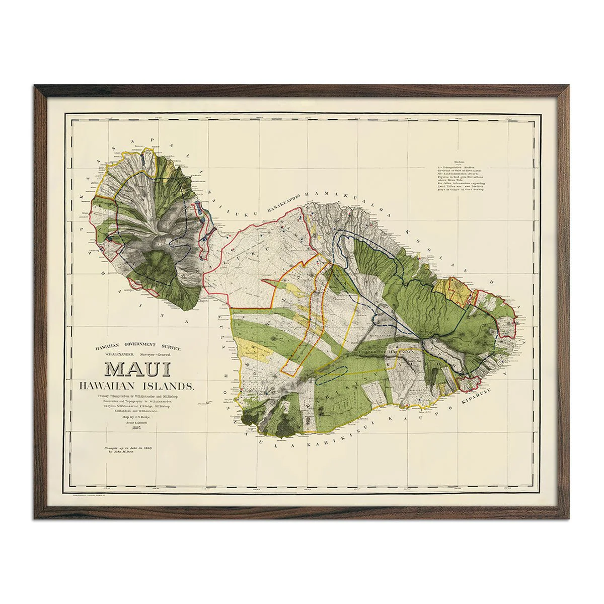
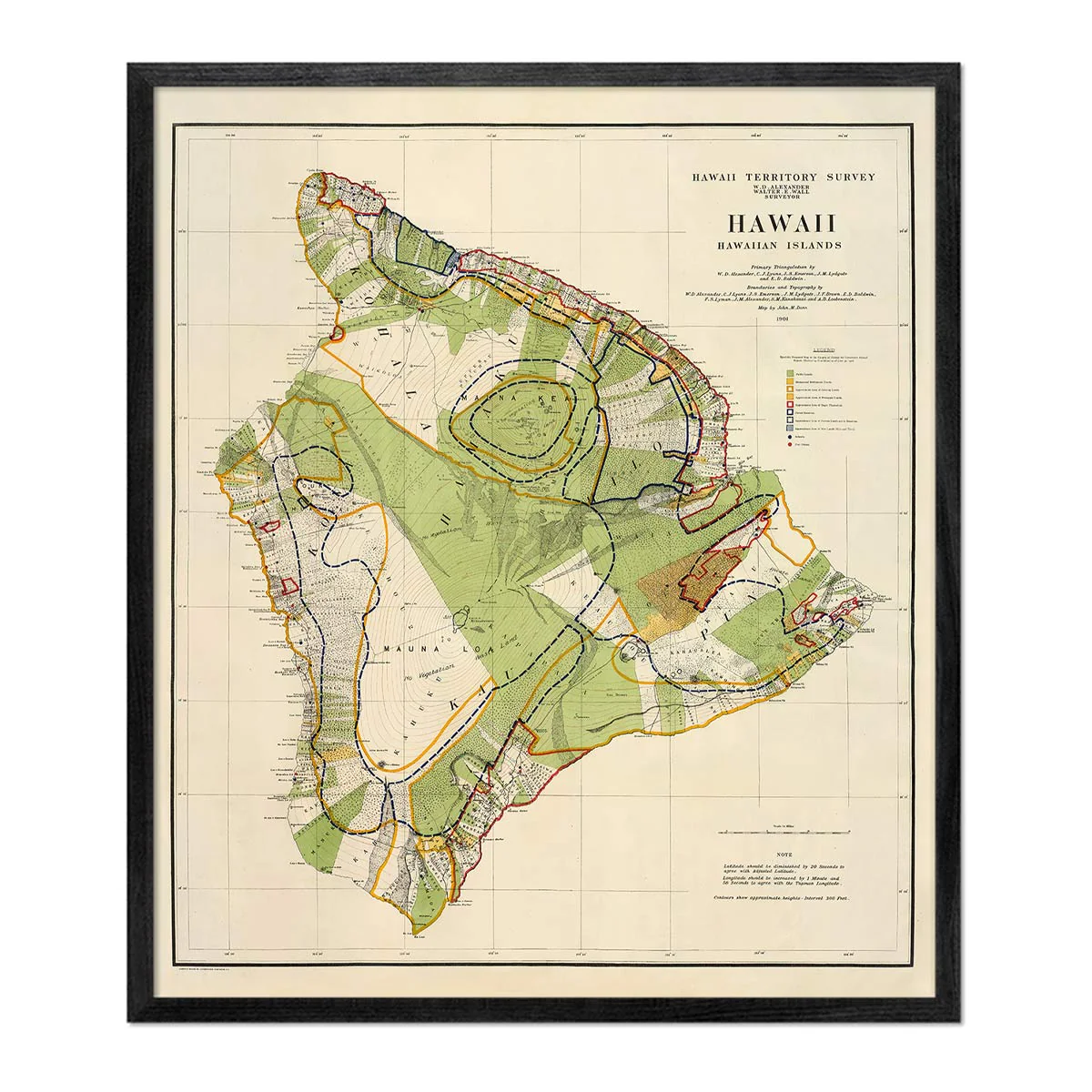
Hawaiian Islands 1918 Map
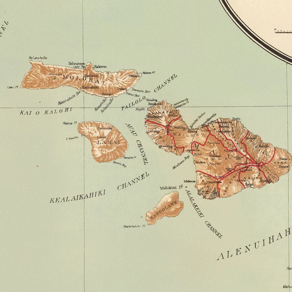
A beautifully restored map of Hawaiian Islands produced by the Department of the Interior in 1918. It was a color lithographed map with relief shown by contours, spot heights, and hachures. Included in the map is a table of distances "from Honolulu to the principal ports of the Pacific."
Product Information
Product Information
Shipping & Returns
Shipping & Returns
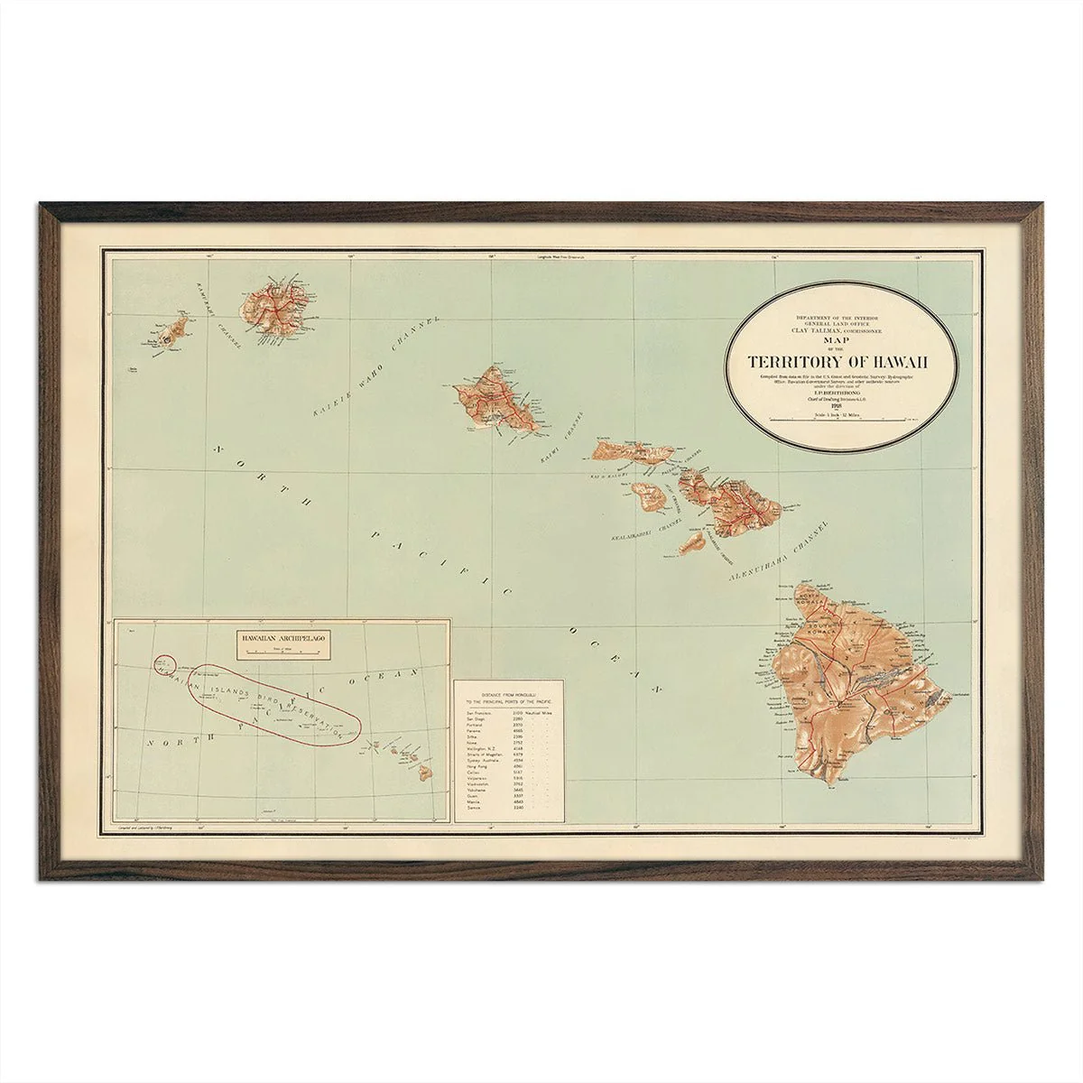
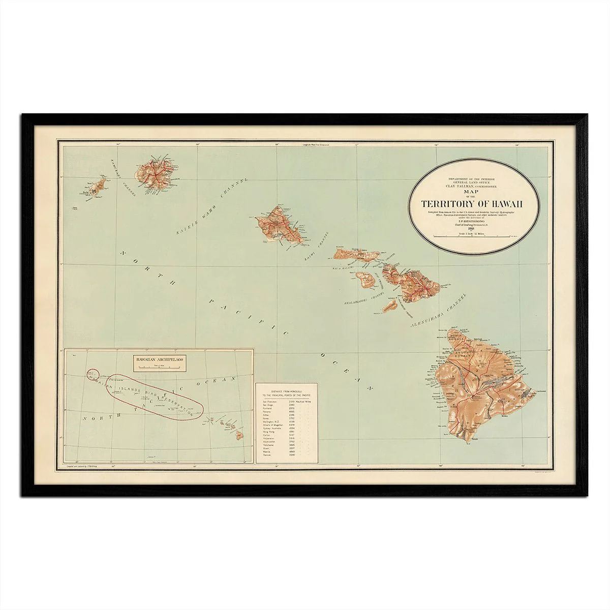

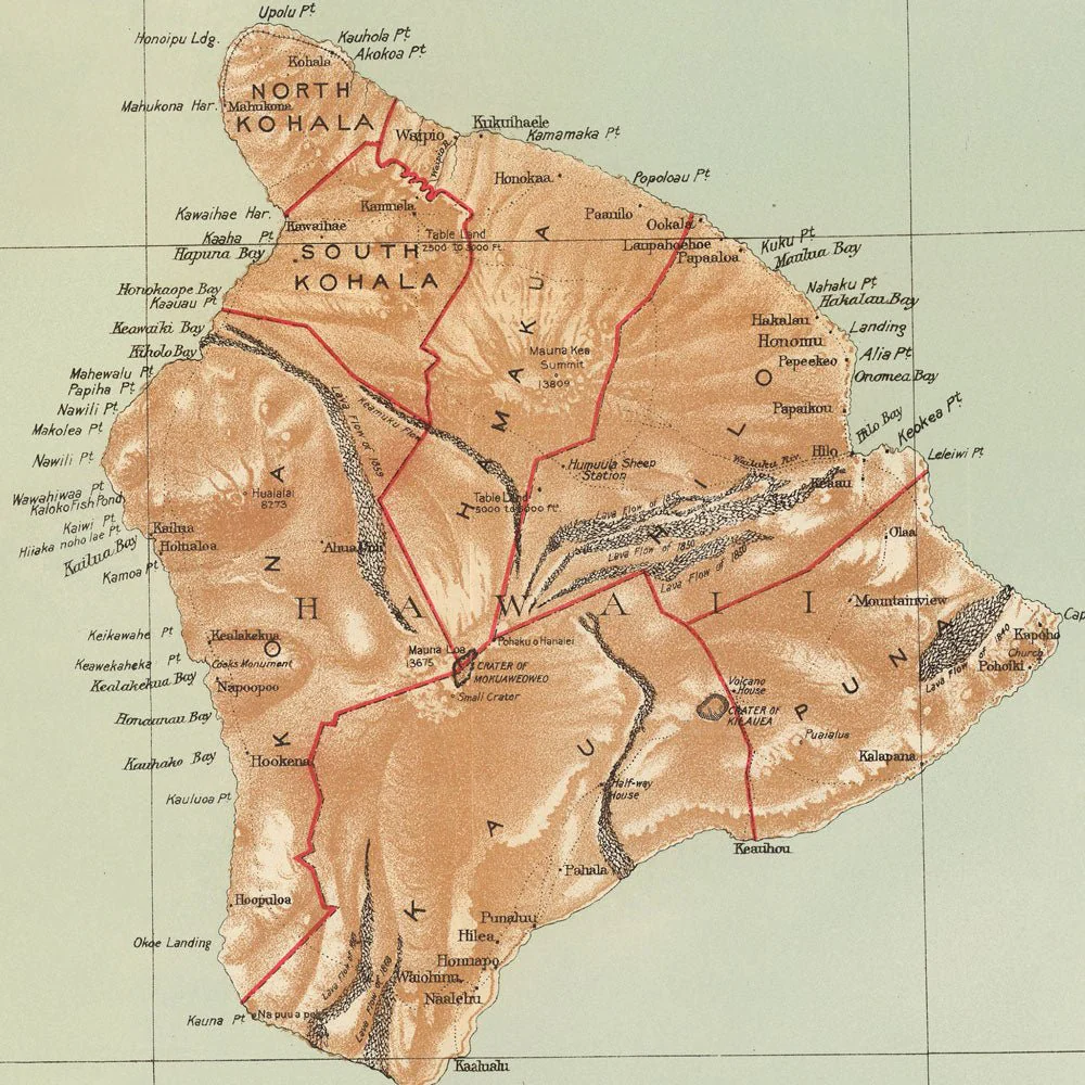
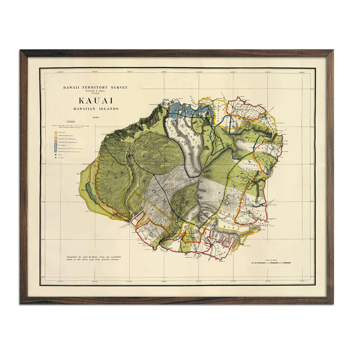
Hawaiian Islands 1918 Map
Hawaiian Islands 1918 Map
A beautifully restored map of Hawaiian Islands produced by the Department of the Interior in 1918. It was a color lithographed map with relief shown by contours, spot heights, and hachures. Included in the map is a table of distances "from Honolulu to the principal ports of the Pacific."
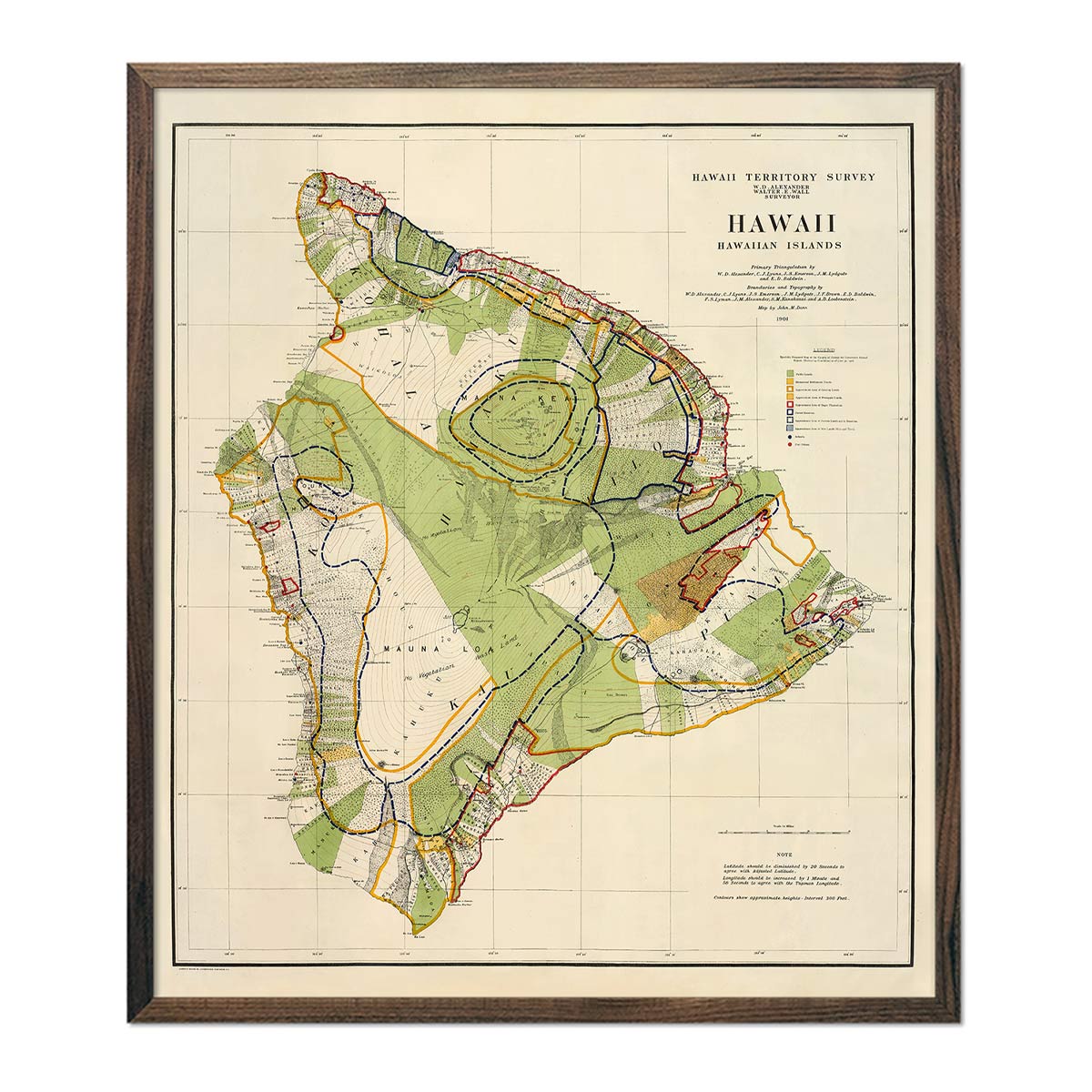
Original: $6,200.00
-70%$6,200.00
$1,860.00Product Information
Product Information
Shipping & Returns
Shipping & Returns
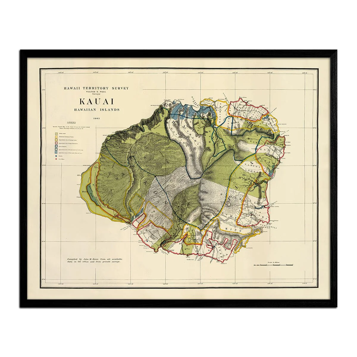
Description
A beautifully restored map of Hawaiian Islands produced by the Department of the Interior in 1918. It was a color lithographed map with relief shown by contours, spot heights, and hachures. Included in the map is a table of distances "from Honolulu to the principal ports of the Pacific."