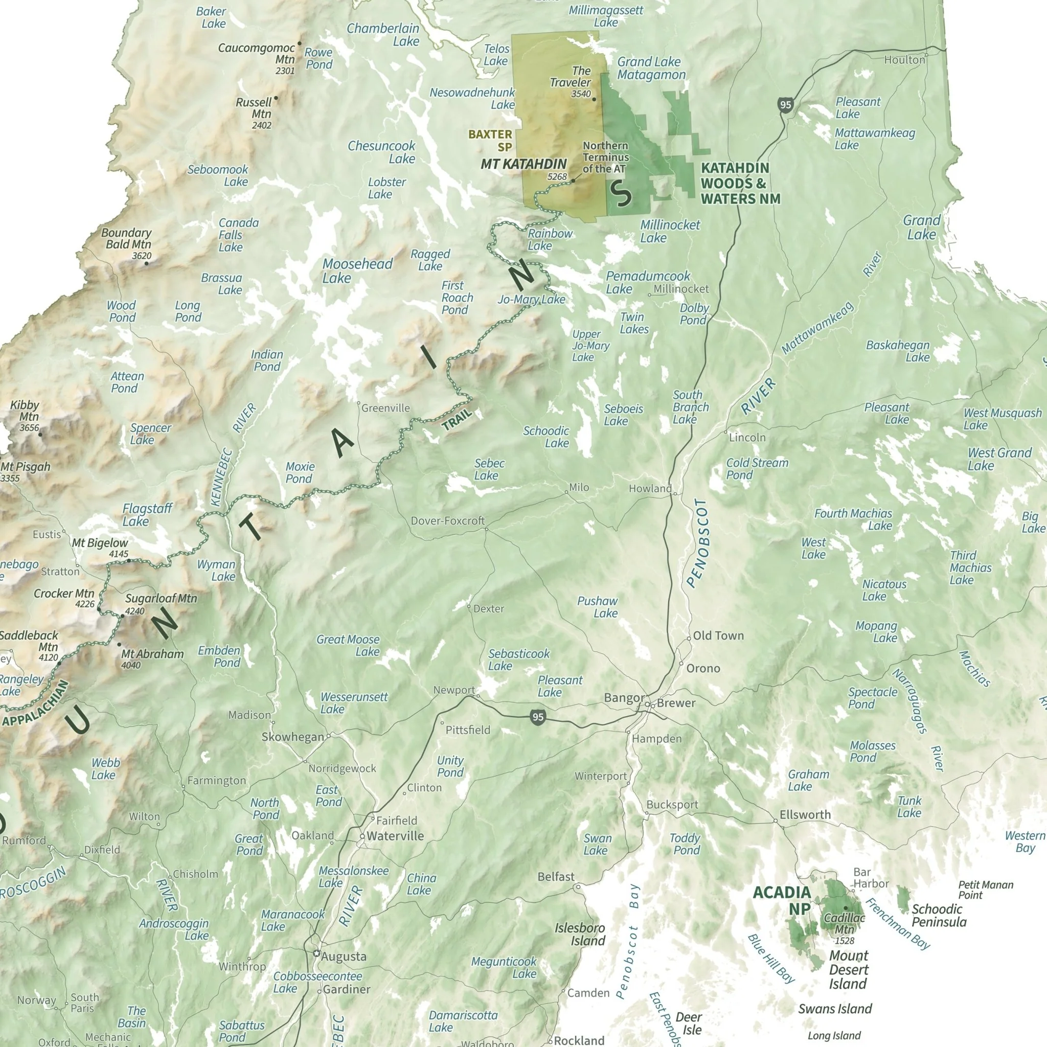
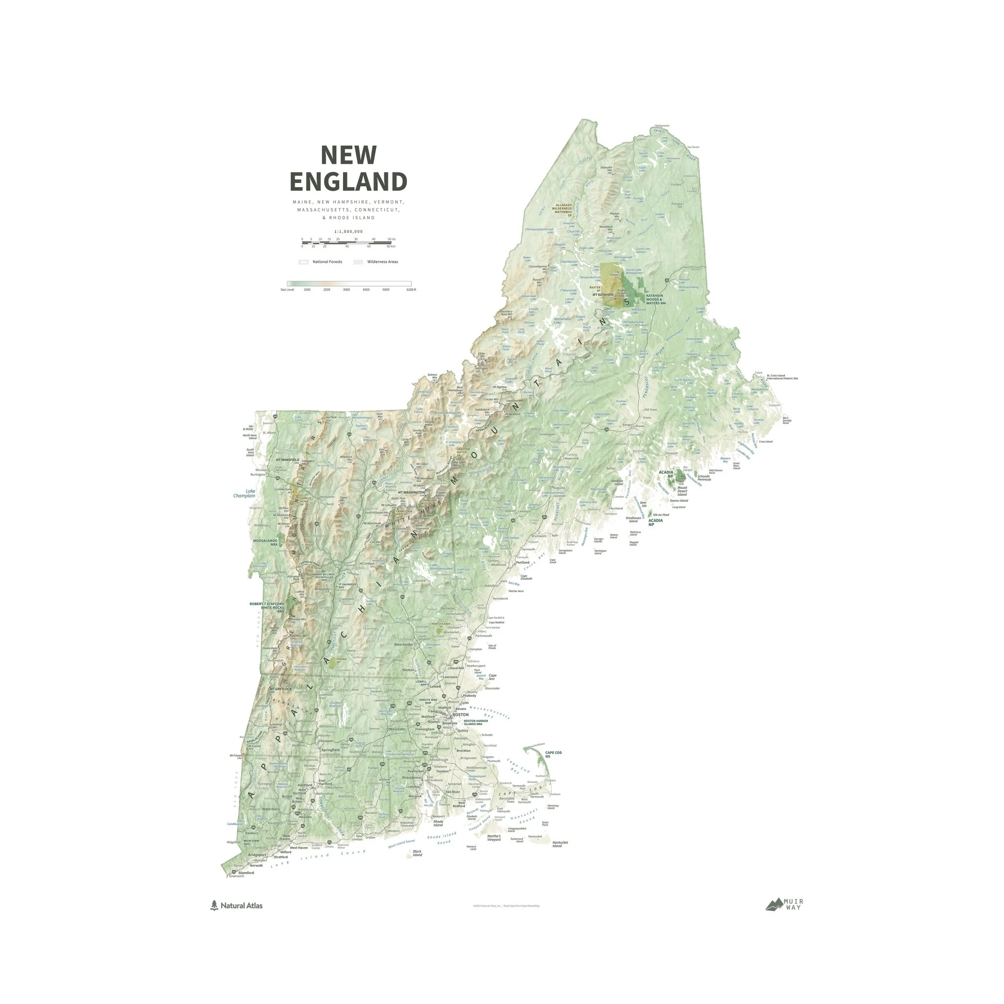
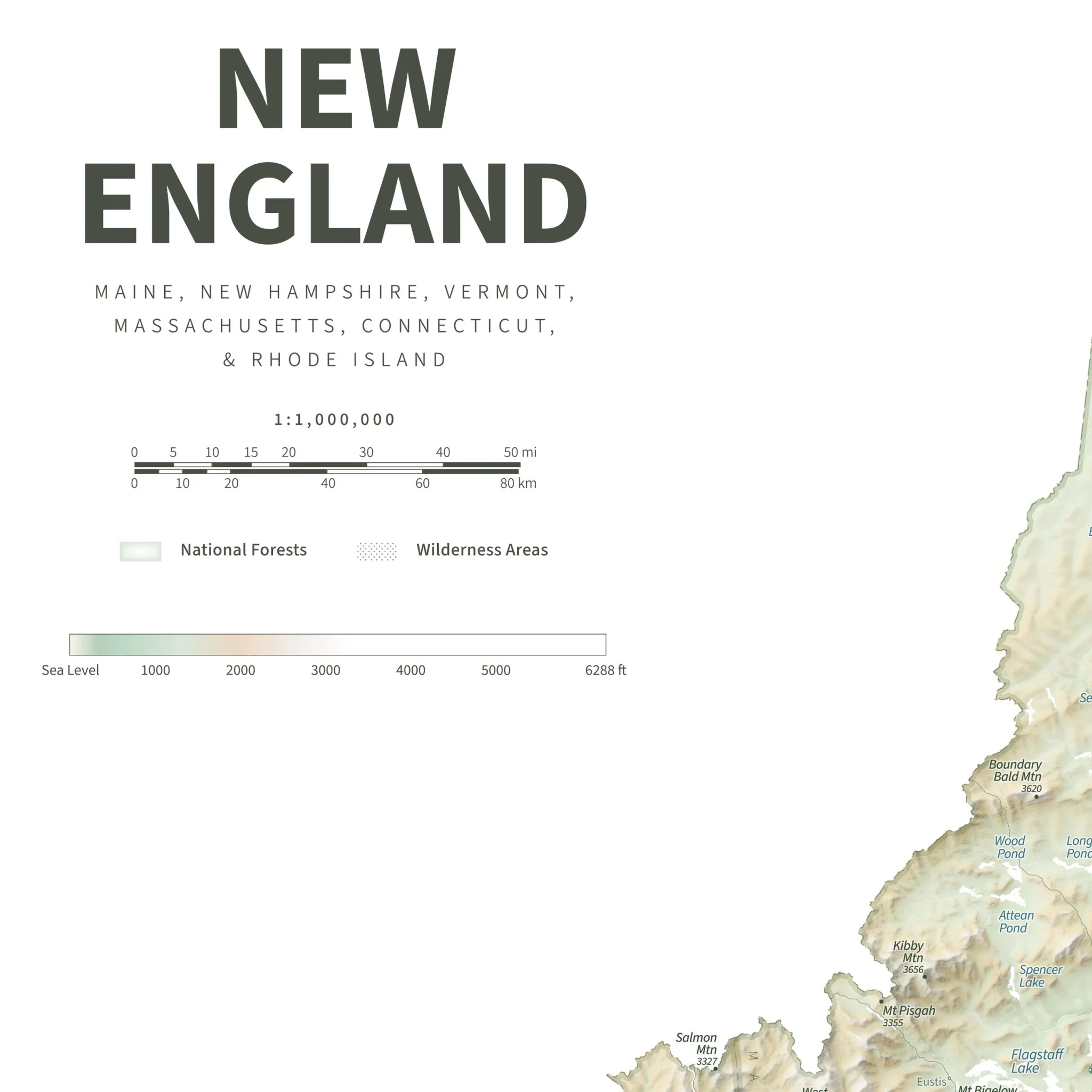
New England Physical Shaded Relief Map
From Mount Washington and the islands of Acadia to the shores of Lake Champlain and the beaches of Cape Cod, this map showcases New England's grand and varied array of spectacular landscapes. Hypsometric tinting illustrates the region's complex topography, contrasting the high peaks with the river valleys, lakes, and coastal areas that lie below. Major peaks, rivers, lakes, islands, bays and other physical features are labeled along with selected cities and towns, providing geographic context to spark memories of past adventures and, hopefully, to inspire future explorations in New England.
Designed in partnership with Natural Atlas.
Product Information
Product Information
Shipping & Returns
Shipping & Returns


New England Physical Shaded Relief Map
New England Physical Shaded Relief Map
From Mount Washington and the islands of Acadia to the shores of Lake Champlain and the beaches of Cape Cod, this map showcases New England's grand and varied array of spectacular landscapes. Hypsometric tinting illustrates the region's complex topography, contrasting the high peaks with the river valleys, lakes, and coastal areas that lie below. Major peaks, rivers, lakes, islands, bays and other physical features are labeled along with selected cities and towns, providing geographic context to spark memories of past adventures and, hopefully, to inspire future explorations in New England.
Designed in partnership with Natural Atlas.
Product Information
Product Information
Shipping & Returns
Shipping & Returns
Description
From Mount Washington and the islands of Acadia to the shores of Lake Champlain and the beaches of Cape Cod, this map showcases New England's grand and varied array of spectacular landscapes. Hypsometric tinting illustrates the region's complex topography, contrasting the high peaks with the river valleys, lakes, and coastal areas that lie below. Major peaks, rivers, lakes, islands, bays and other physical features are labeled along with selected cities and towns, providing geographic context to spark memories of past adventures and, hopefully, to inspire future explorations in New England.
Designed in partnership with Natural Atlas.