🚚 Free Worldwide Shipping on All Orders!Shop Now
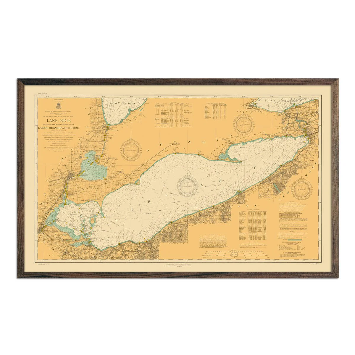
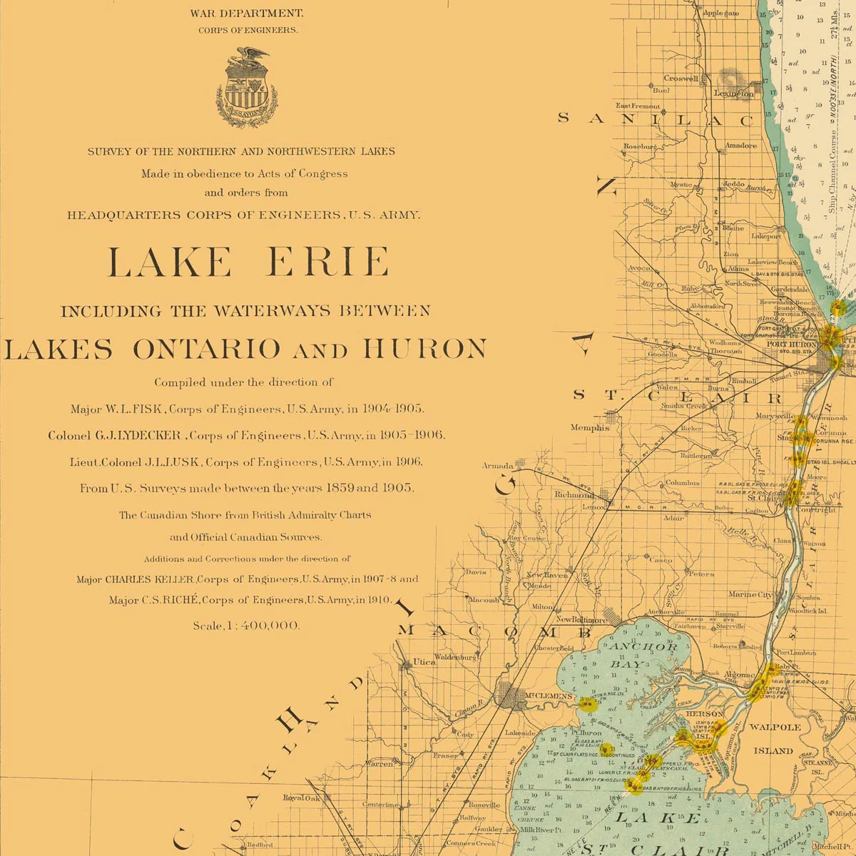
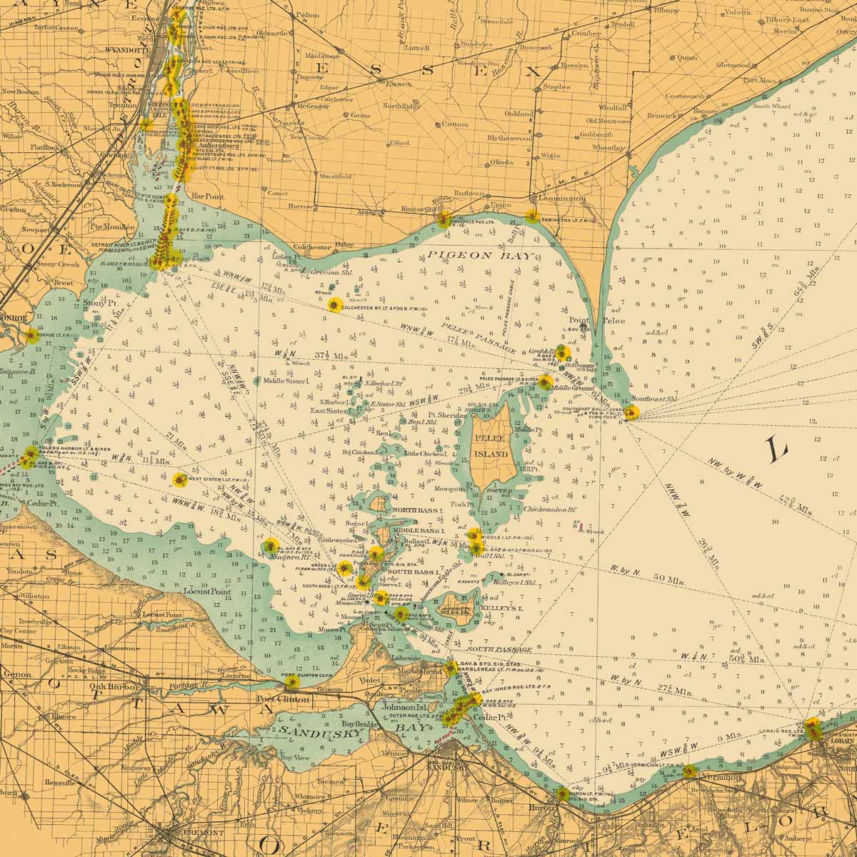
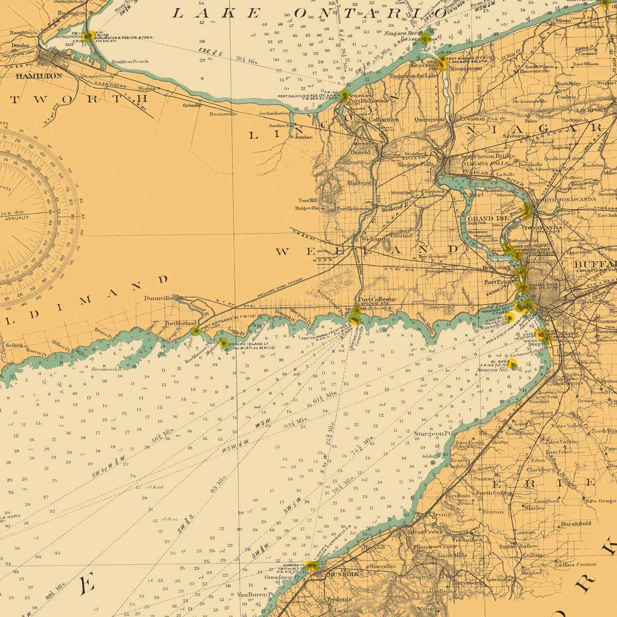
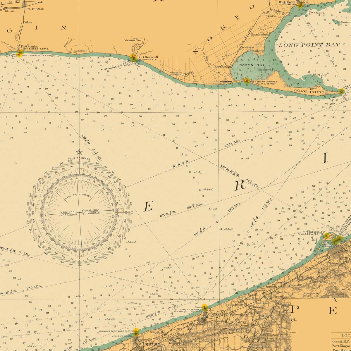
Lake Erie and Waterways between Lakes Ontario and Huron Nautical Chart 1910
We digitally corrected the original map by removing creases, tears, writing, stamps, etc., to create a remastered version of this historical Lake Erie map.
Product Information
Product Information
Shipping & Returns
Shipping & Returns
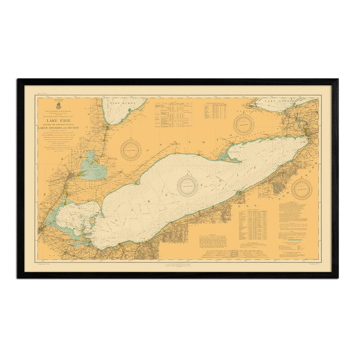
Lake Erie and Waterways between Lakes Ontario and Huron Nautical Chart 1910
Lake Erie and Waterways between Lakes Ontario and Huron Nautical Chart 1910
We digitally corrected the original map by removing creases, tears, writing, stamps, etc., to create a remastered version of this historical Lake Erie map.
Select Size
Select Material
Select Frame
From $462,900.00
Original: $1,543,000.00
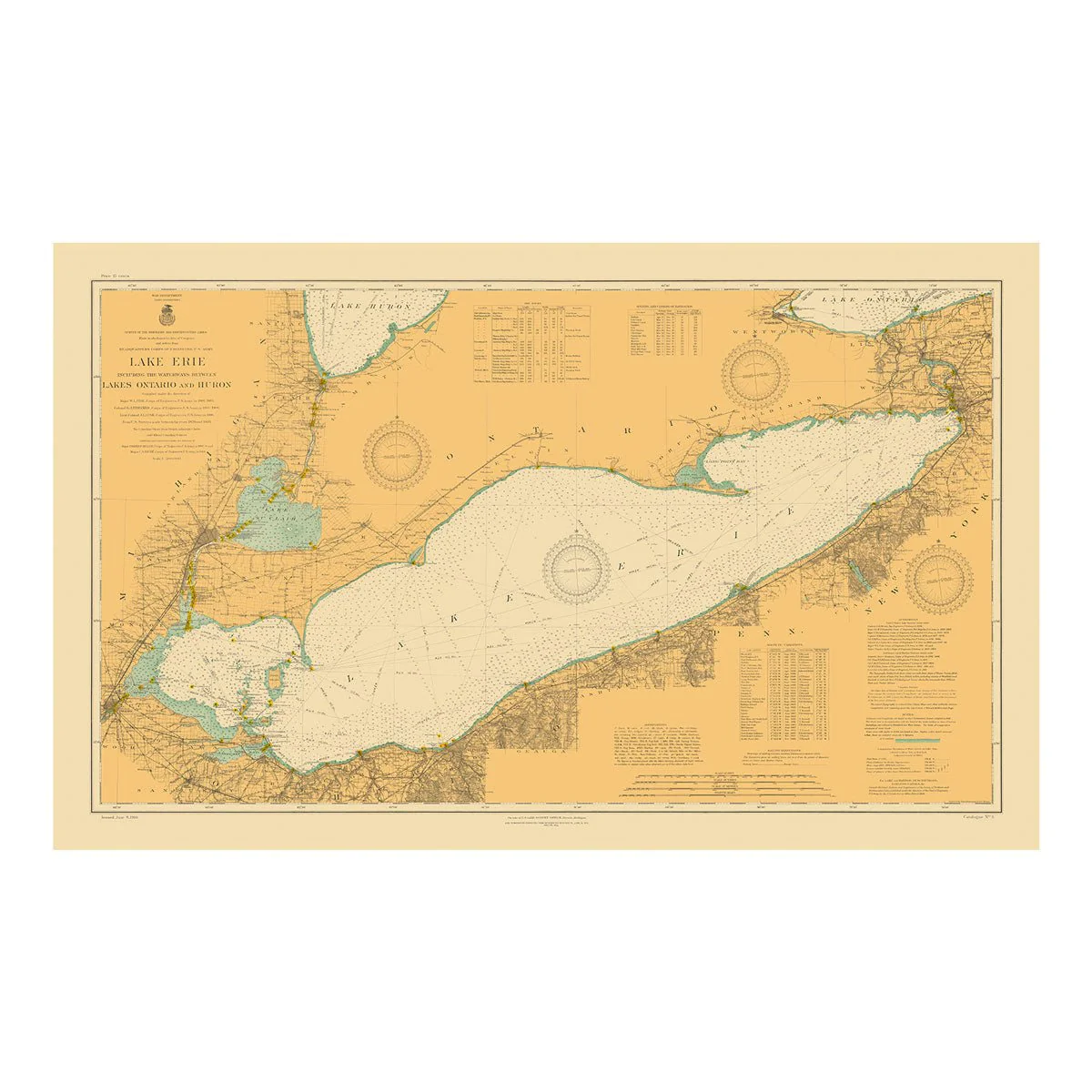
-70%Lake Erie and Waterways between Lakes Ontario and Huron Nautical Chart 1910—
$1,543,000.00
$462,900.00Product Information
Product Information
Shipping & Returns
Shipping & Returns
Description
We digitally corrected the original map by removing creases, tears, writing, stamps, etc., to create a remastered version of this historical Lake Erie map.