🚚 Free Worldwide Shipping on All Orders!Shop Now
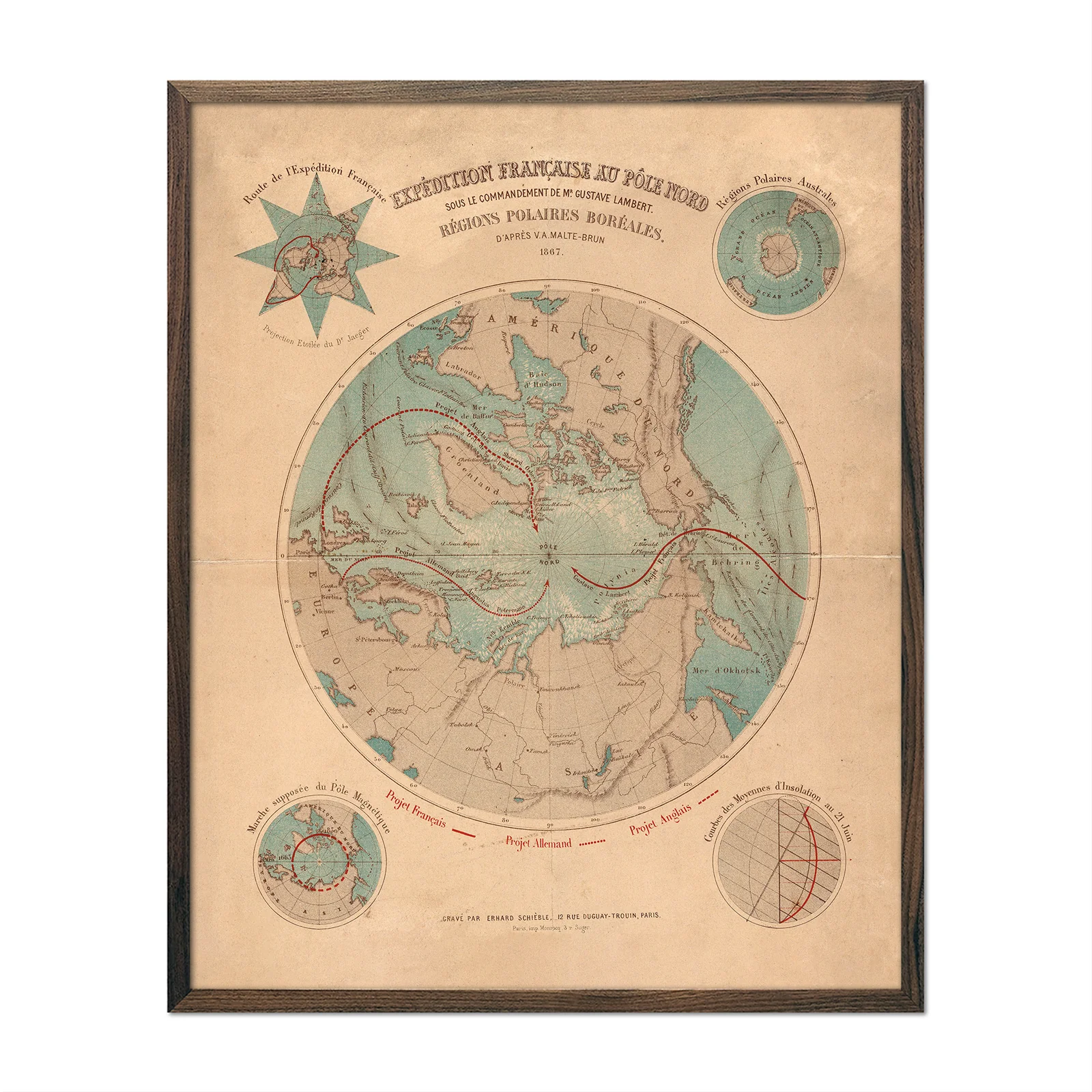
Expedition Francaise Au Pole Nord
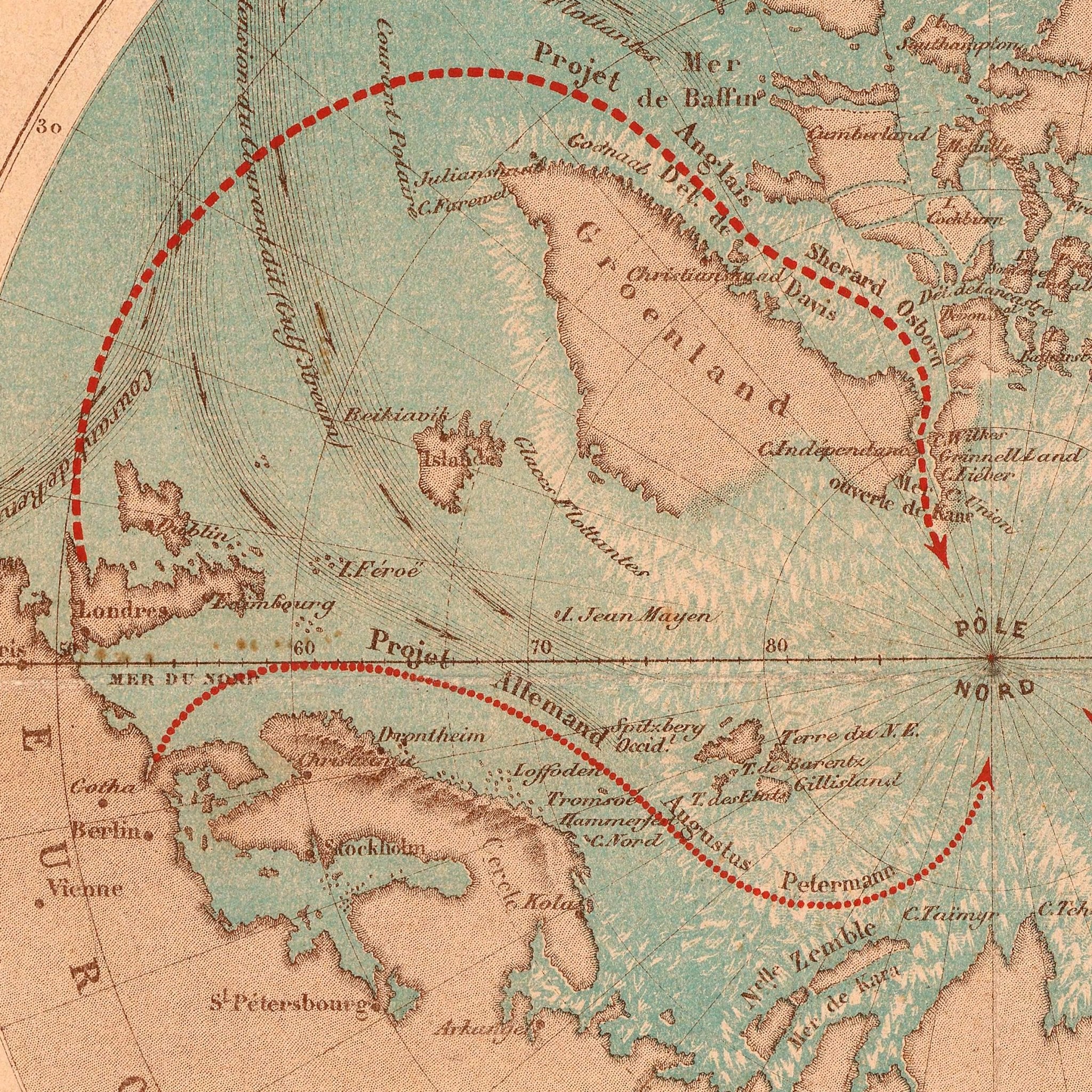
In 1867, French hydrographer Gustave Lambert proposed reaching the North Pole by harnessing the Gulf Stream's warm currents. This vintage map shows Lambert's seafaring route alongside the projected German and English expeditions. The map includes his detailed ocean current systems. Though the French government rejected his plan, Lambert's work created this comprehensive document of three nations' competing approaches to Arctic exploration.
This reproduction preserves Lambert's original 1867 cartography. The map includes expedition route illustrations and Gulf Stream current mapping. It represents the scientific artistry of 1860s mapmaking and documents an ambitious but unrealized exploration proposal.
This map is ideal for history enthusiasts, polar exploration fans, or those wanting distinctive home décor. We carefully remastered it and reproduce it in San Diego, California using American materials.
Lambert's rejected proposal became a fascinating record of 19th-century exploration ambition.
Product Information
Product Information
Shipping & Returns
Shipping & Returns
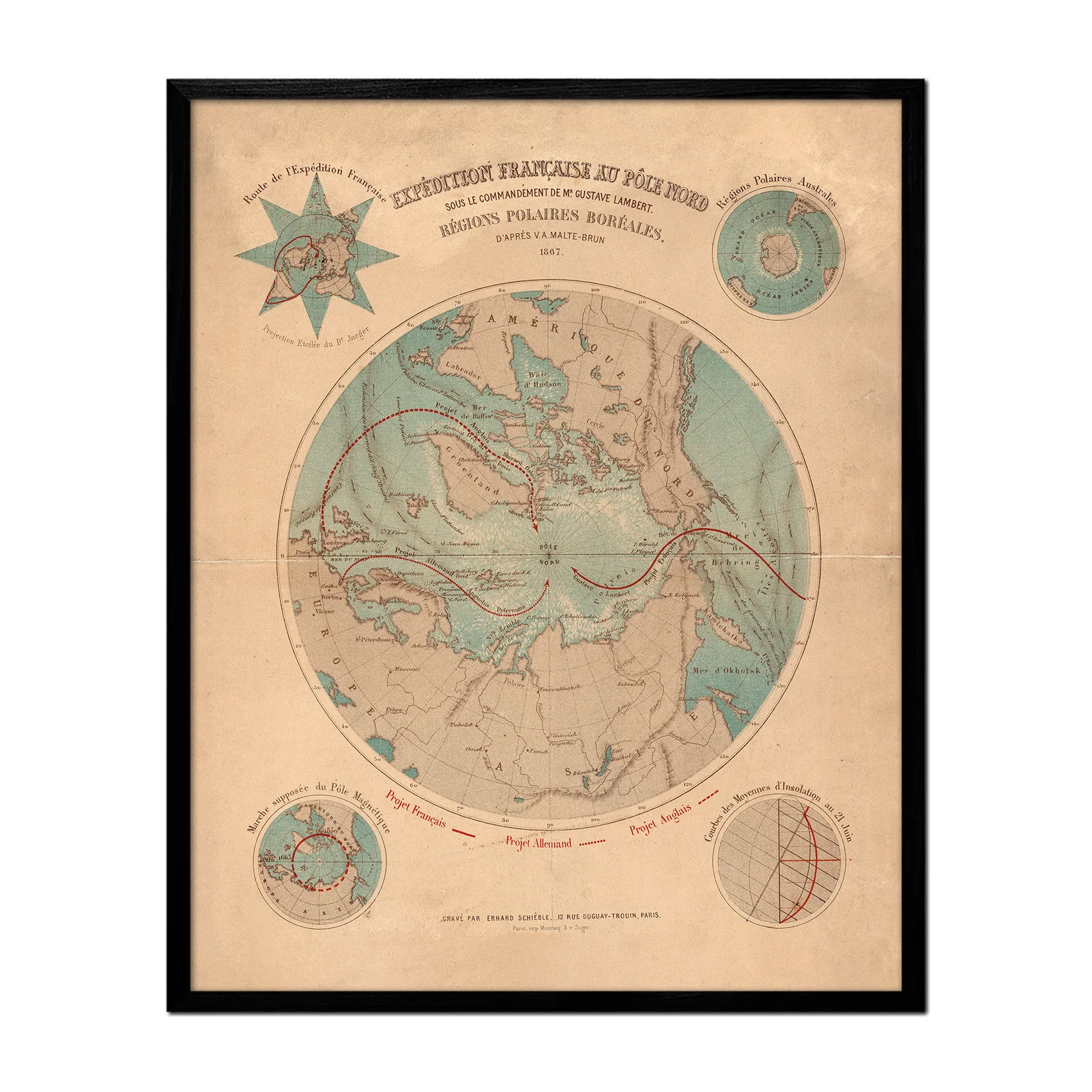

Expedition Francaise Au Pole Nord
Expedition Francaise Au Pole Nord
In 1867, French hydrographer Gustave Lambert proposed reaching the North Pole by harnessing the Gulf Stream's warm currents. This vintage map shows Lambert's seafaring route alongside the projected German and English expeditions. The map includes his detailed ocean current systems. Though the French government rejected his plan, Lambert's work created this comprehensive document of three nations' competing approaches to Arctic exploration.
This reproduction preserves Lambert's original 1867 cartography. The map includes expedition route illustrations and Gulf Stream current mapping. It represents the scientific artistry of 1860s mapmaking and documents an ambitious but unrealized exploration proposal.
This map is ideal for history enthusiasts, polar exploration fans, or those wanting distinctive home décor. We carefully remastered it and reproduce it in San Diego, California using American materials.
Lambert's rejected proposal became a fascinating record of 19th-century exploration ambition.
Select Size
Select Material
Select Frame
From $151.20
Original: $504.00
-70%Expedition Francaise Au Pole Nord—
$504.00
$151.20Product Information
Product Information
Shipping & Returns
Shipping & Returns
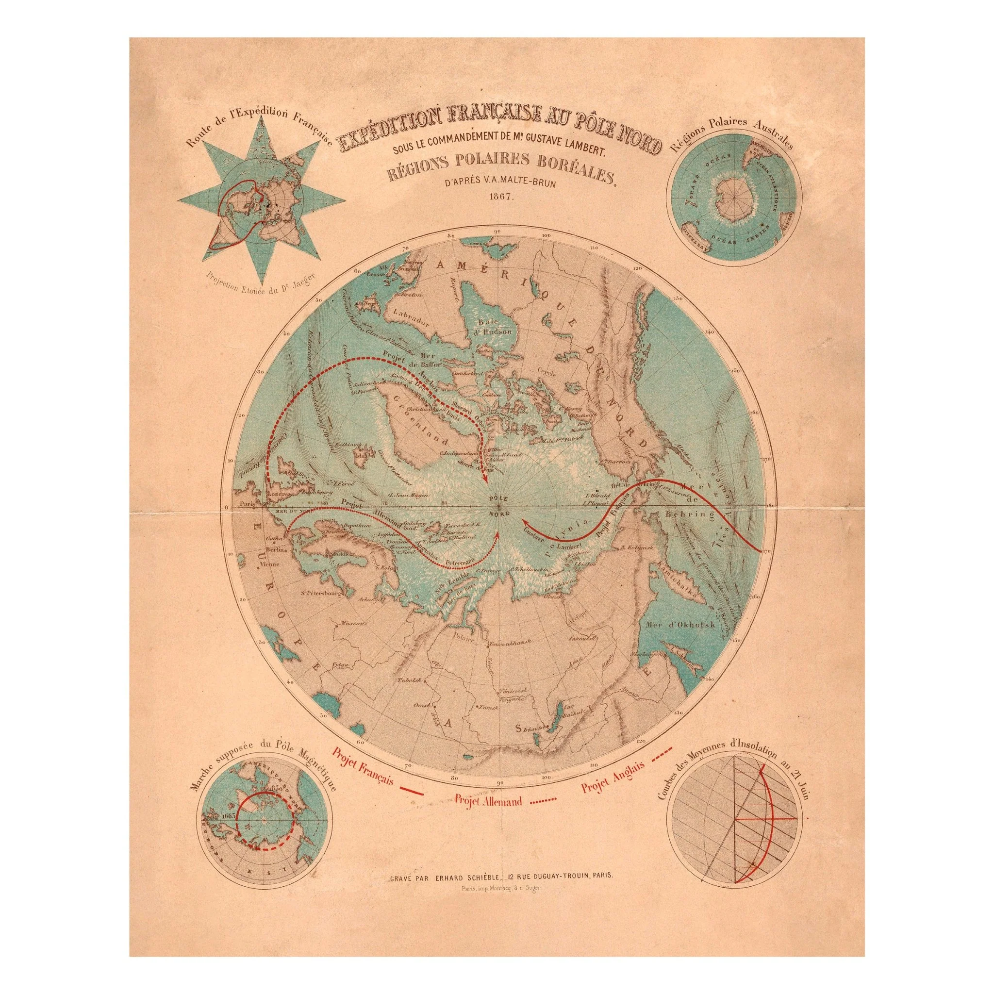
Description
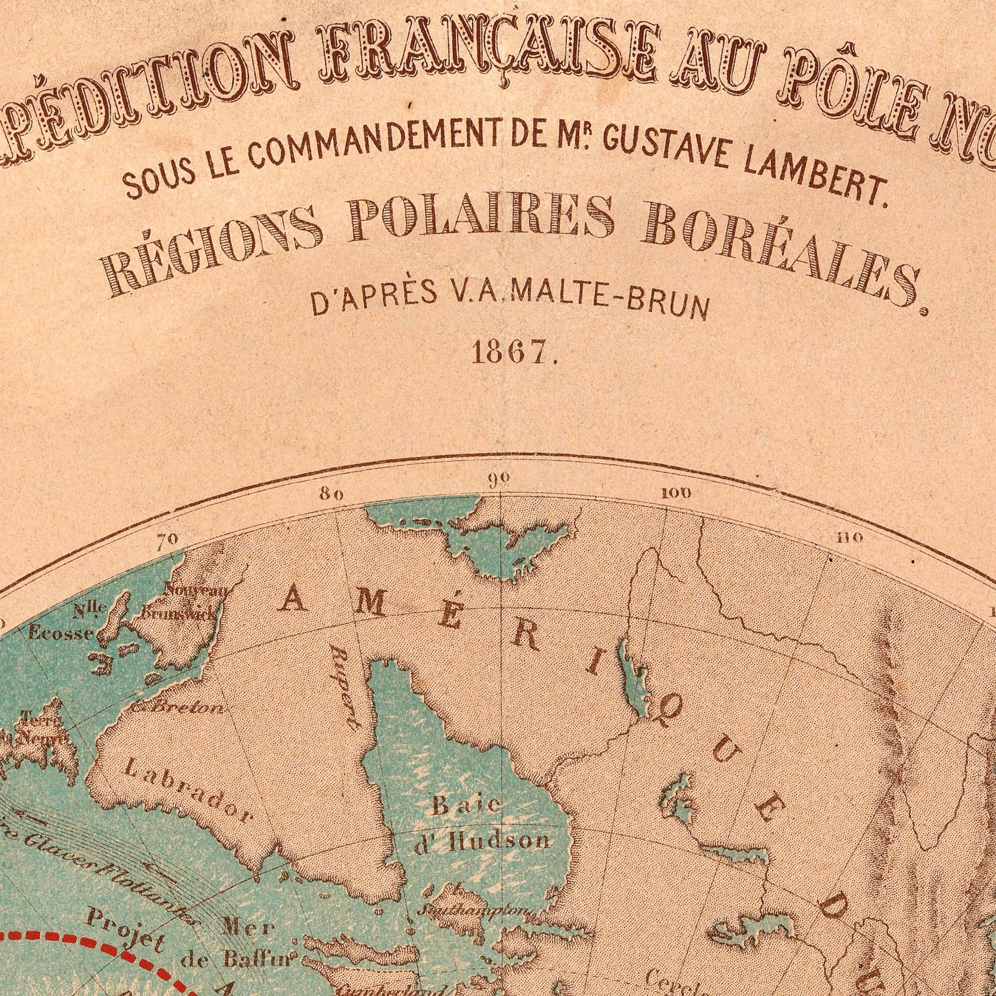
In 1867, French hydrographer Gustave Lambert proposed reaching the North Pole by harnessing the Gulf Stream's warm currents. This vintage map shows Lambert's seafaring route alongside the projected German and English expeditions. The map includes his detailed ocean current systems. Though the French government rejected his plan, Lambert's work created this comprehensive document of three nations' competing approaches to Arctic exploration.
This reproduction preserves Lambert's original 1867 cartography. The map includes expedition route illustrations and Gulf Stream current mapping. It represents the scientific artistry of 1860s mapmaking and documents an ambitious but unrealized exploration proposal.
This map is ideal for history enthusiasts, polar exploration fans, or those wanting distinctive home décor. We carefully remastered it and reproduce it in San Diego, California using American materials.
Lambert's rejected proposal became a fascinating record of 19th-century exploration ambition.