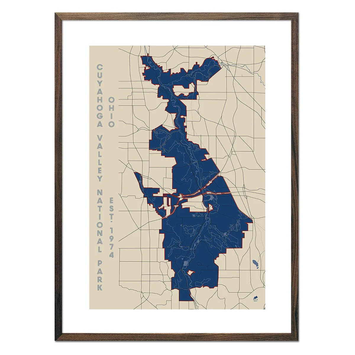
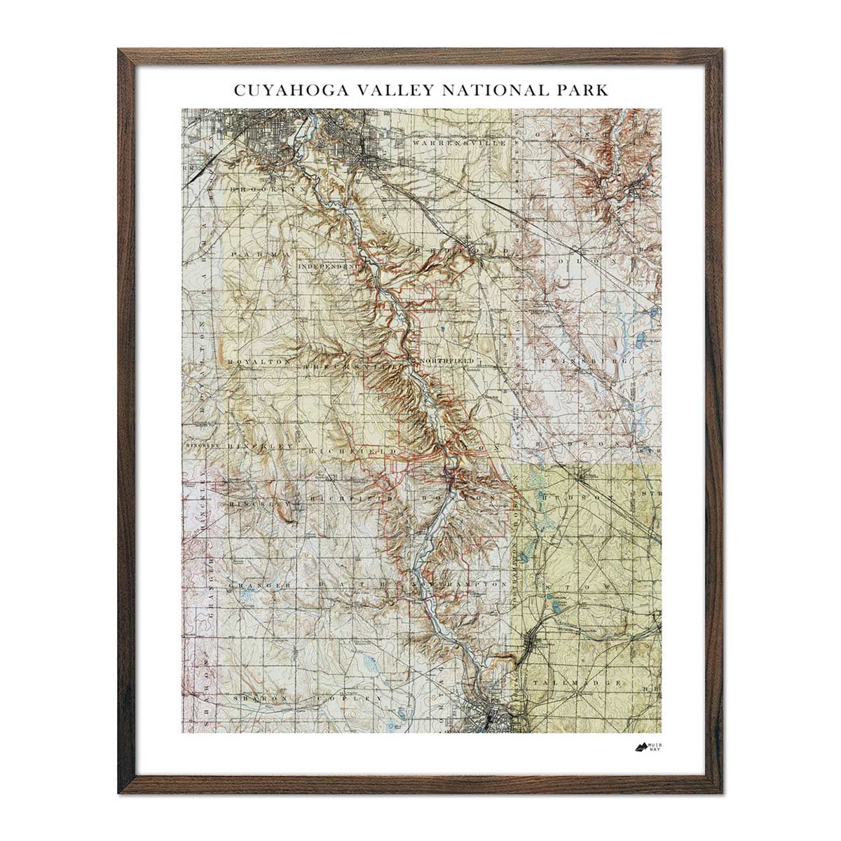
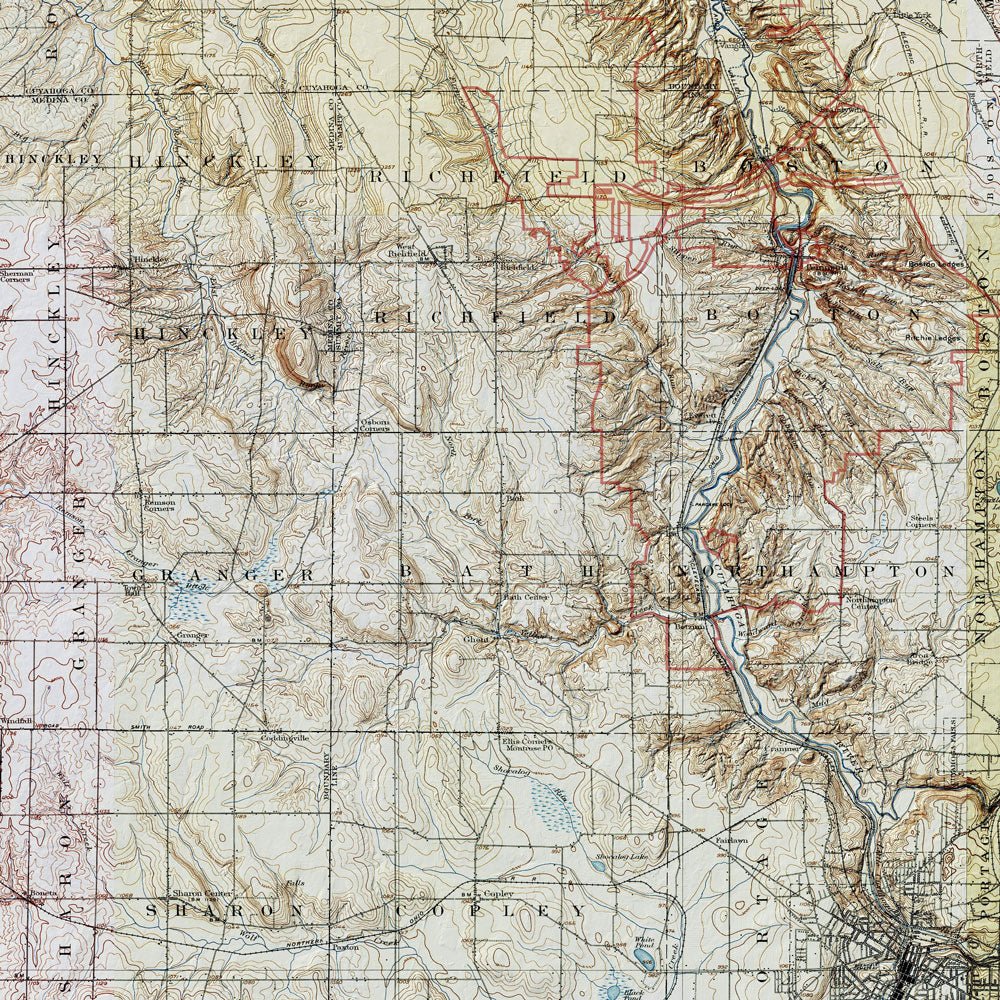
Cuyahoga Valley Shaded Relief Map
Made from combining 6 historic USGS topographic maps together with modern elevation data, our Cuyahoga Valley Relief map will captivate you with its endless details that appear to pop off the paper, adding depth and dimension to the vintage maps.
We selected maps from different years throughout the early 1900s that were digitally patched together, creating a composite that encompasses the entire park. Once merged, a mosaic of the topographic maps was formed from the different colors and styles of the individual maps. The map comes to life with the addition of hillshading derived from advanced elevation data that gives the landscape a 3-dimensional appearance. Lastly, we overlaid the current boundary of the park in red, which oftentimes differ from the older versions of the park borders that appear on the vintage USGS maps used.
Discover Cuyahoga Valley in a whole new way with a bird's eye view of the park while you search for new adventures and relive your old ones.
Product Information
Product Information
Shipping & Returns
Shipping & Returns

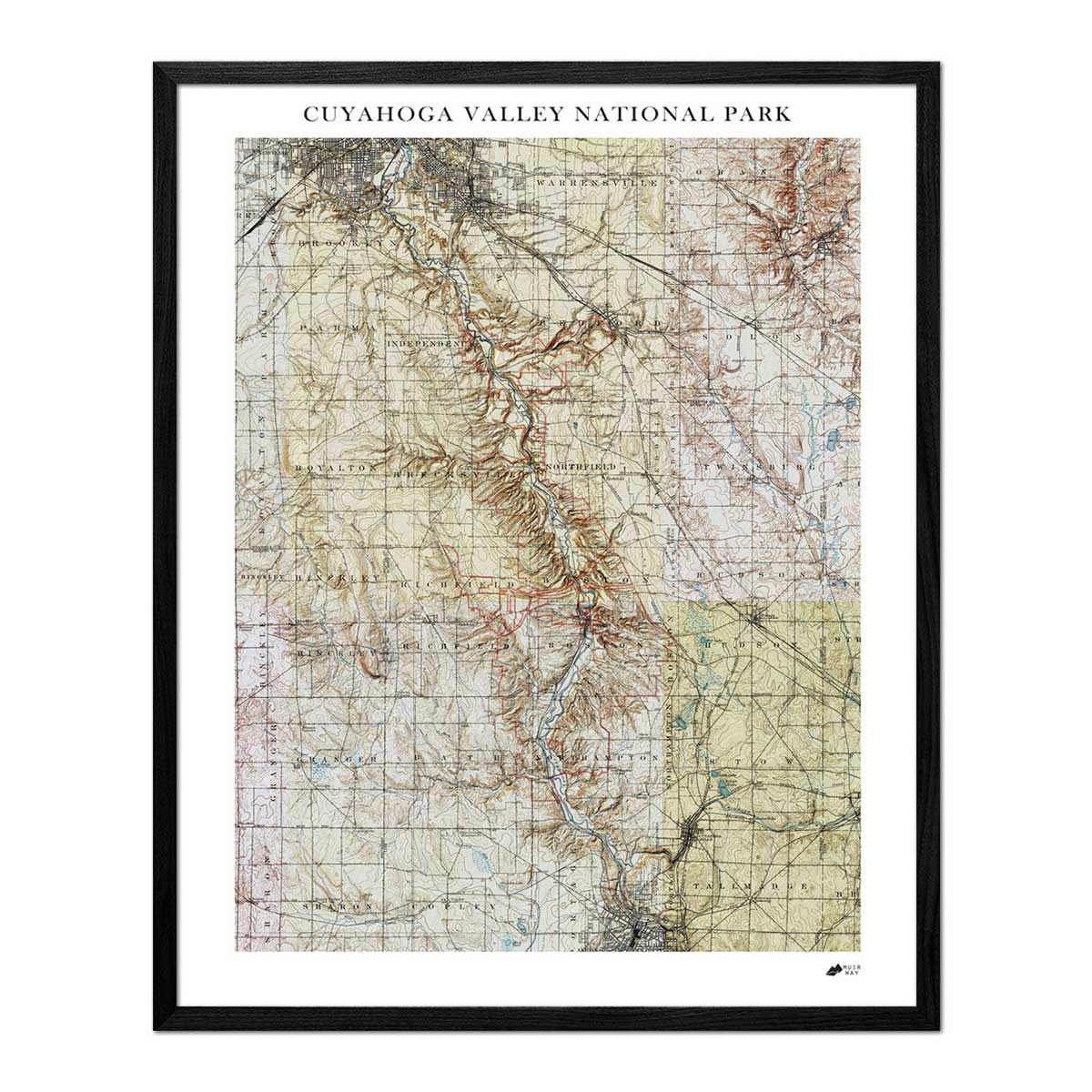
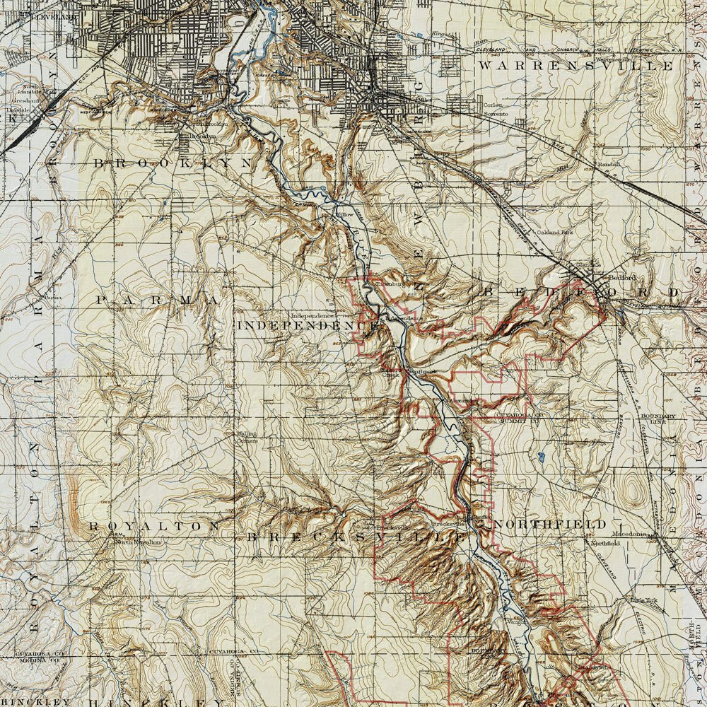
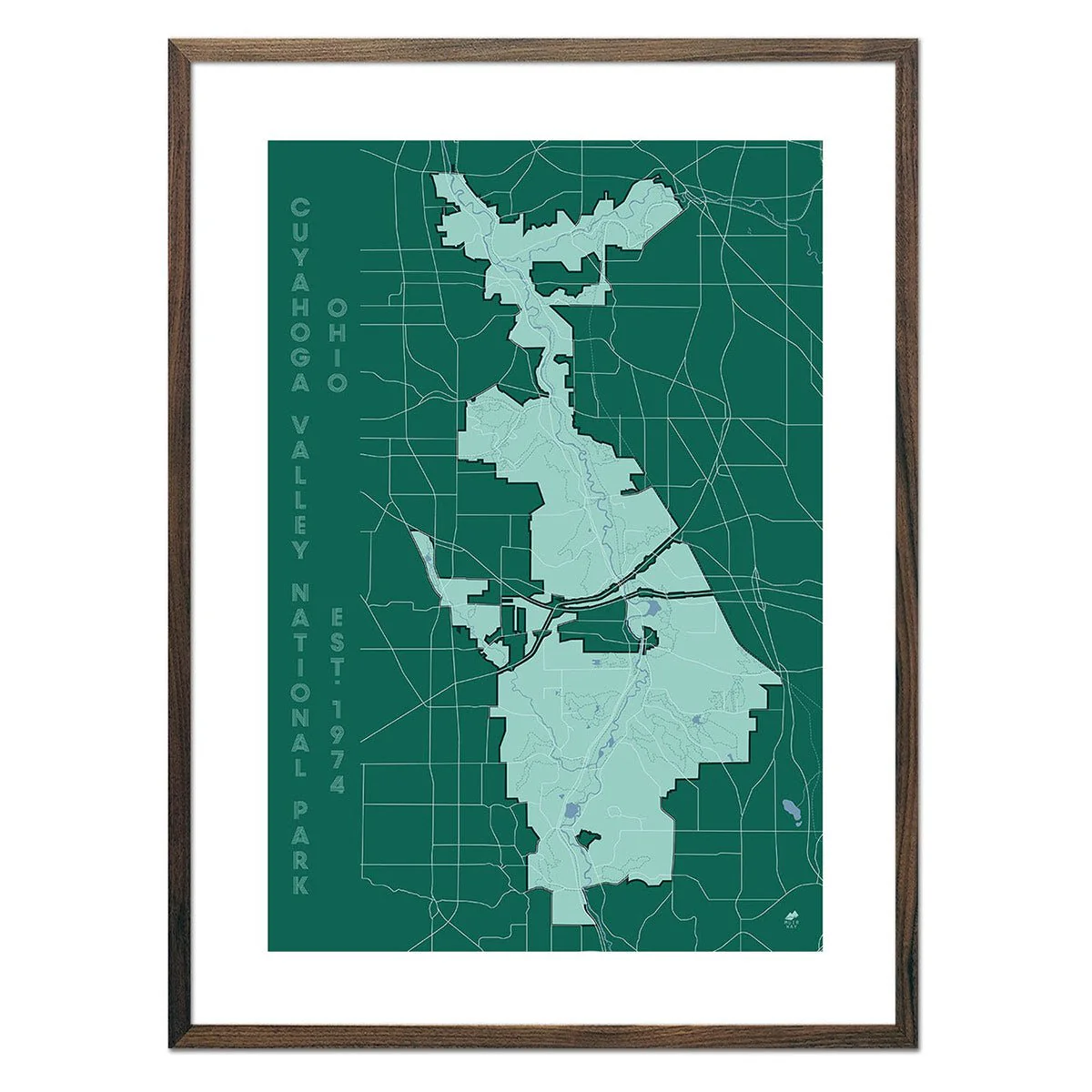
Cuyahoga Valley Shaded Relief Map
Cuyahoga Valley Shaded Relief Map
Made from combining 6 historic USGS topographic maps together with modern elevation data, our Cuyahoga Valley Relief map will captivate you with its endless details that appear to pop off the paper, adding depth and dimension to the vintage maps.
We selected maps from different years throughout the early 1900s that were digitally patched together, creating a composite that encompasses the entire park. Once merged, a mosaic of the topographic maps was formed from the different colors and styles of the individual maps. The map comes to life with the addition of hillshading derived from advanced elevation data that gives the landscape a 3-dimensional appearance. Lastly, we overlaid the current boundary of the park in red, which oftentimes differ from the older versions of the park borders that appear on the vintage USGS maps used.
Discover Cuyahoga Valley in a whole new way with a bird's eye view of the park while you search for new adventures and relive your old ones.
Original: $7,100.00
-70%$7,100.00
$2,130.00Product Information
Product Information
Shipping & Returns
Shipping & Returns
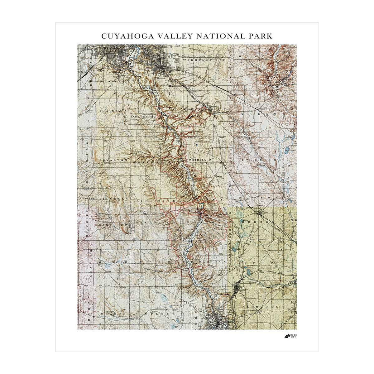
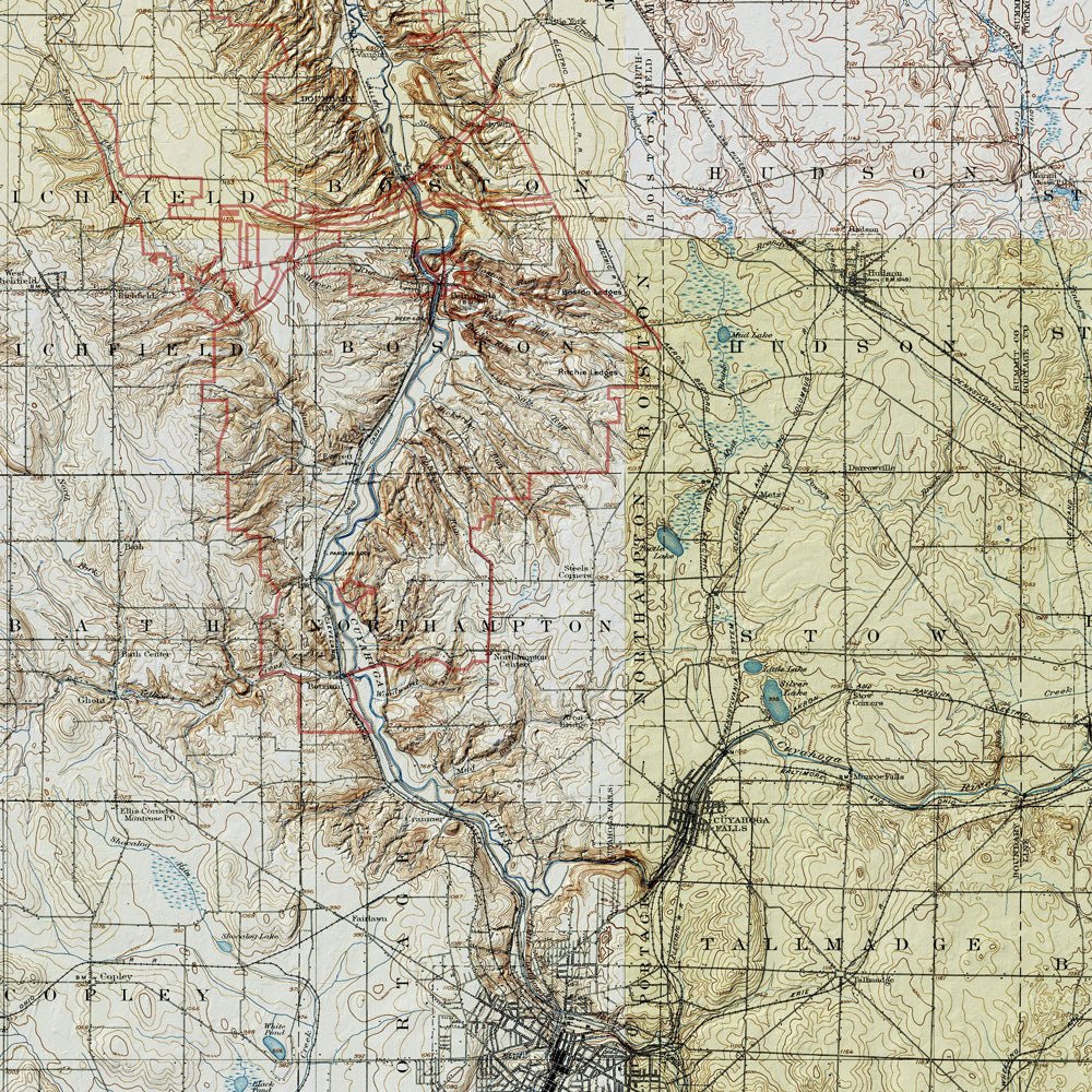
Description
Made from combining 6 historic USGS topographic maps together with modern elevation data, our Cuyahoga Valley Relief map will captivate you with its endless details that appear to pop off the paper, adding depth and dimension to the vintage maps.
We selected maps from different years throughout the early 1900s that were digitally patched together, creating a composite that encompasses the entire park. Once merged, a mosaic of the topographic maps was formed from the different colors and styles of the individual maps. The map comes to life with the addition of hillshading derived from advanced elevation data that gives the landscape a 3-dimensional appearance. Lastly, we overlaid the current boundary of the park in red, which oftentimes differ from the older versions of the park borders that appear on the vintage USGS maps used.
Discover Cuyahoga Valley in a whole new way with a bird's eye view of the park while you search for new adventures and relive your old ones.