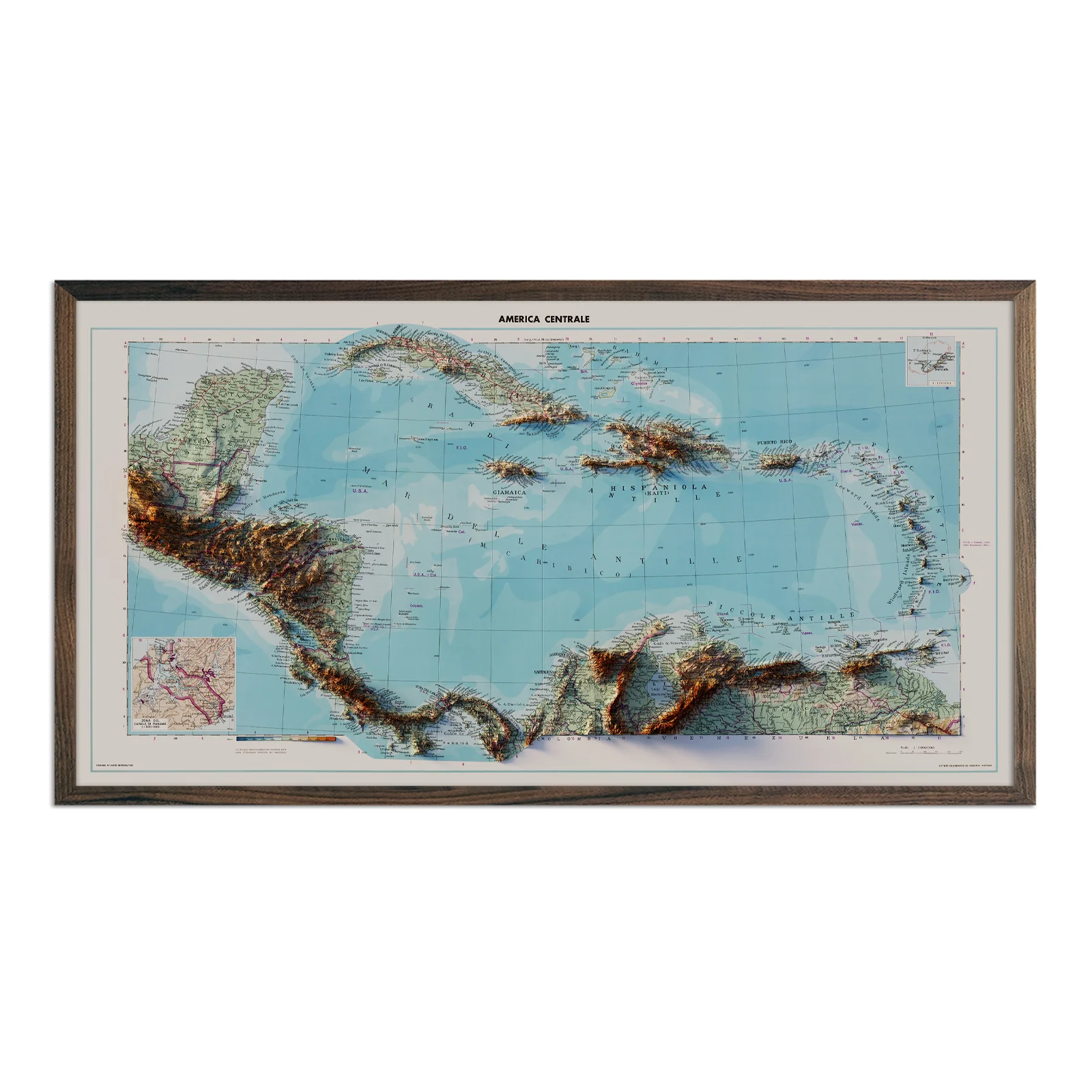
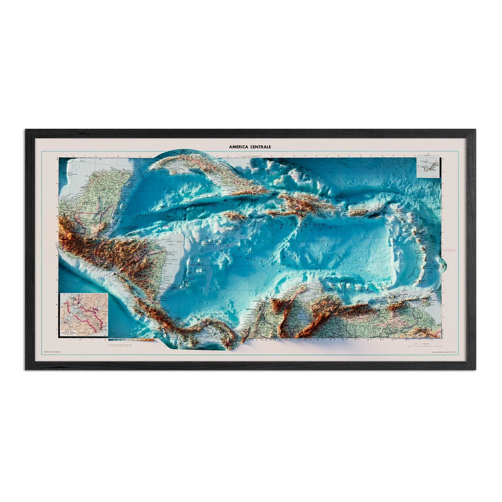
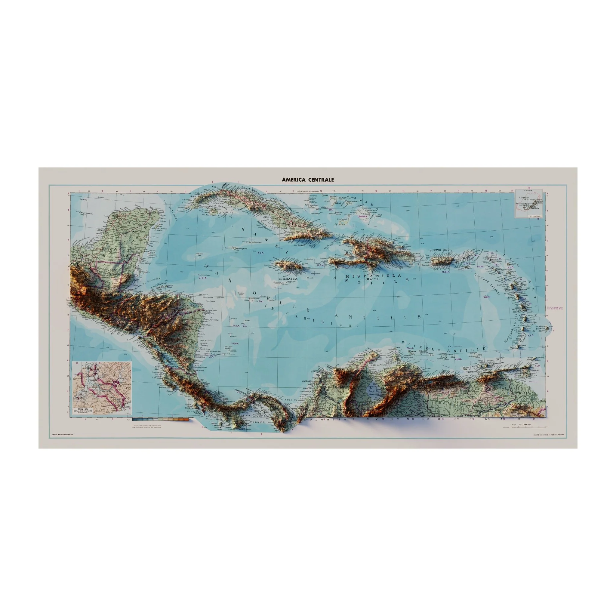
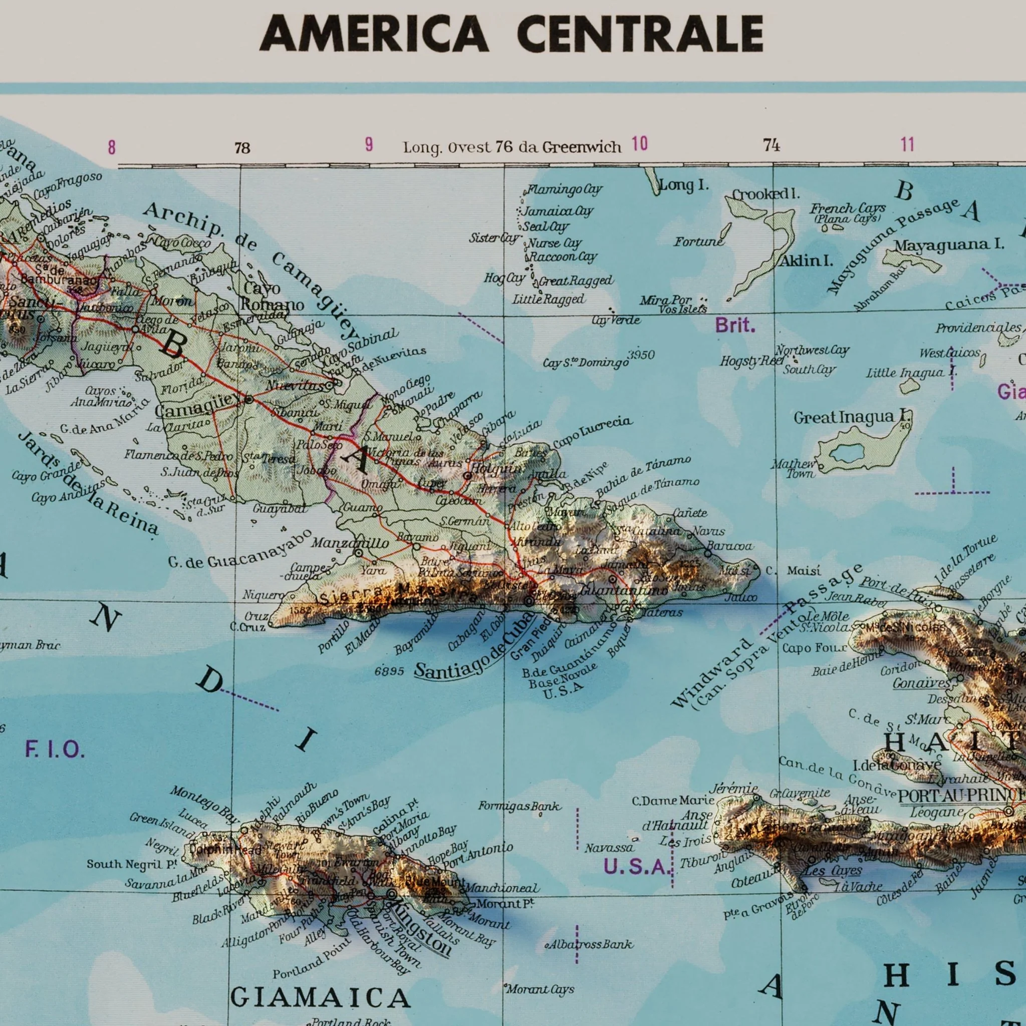
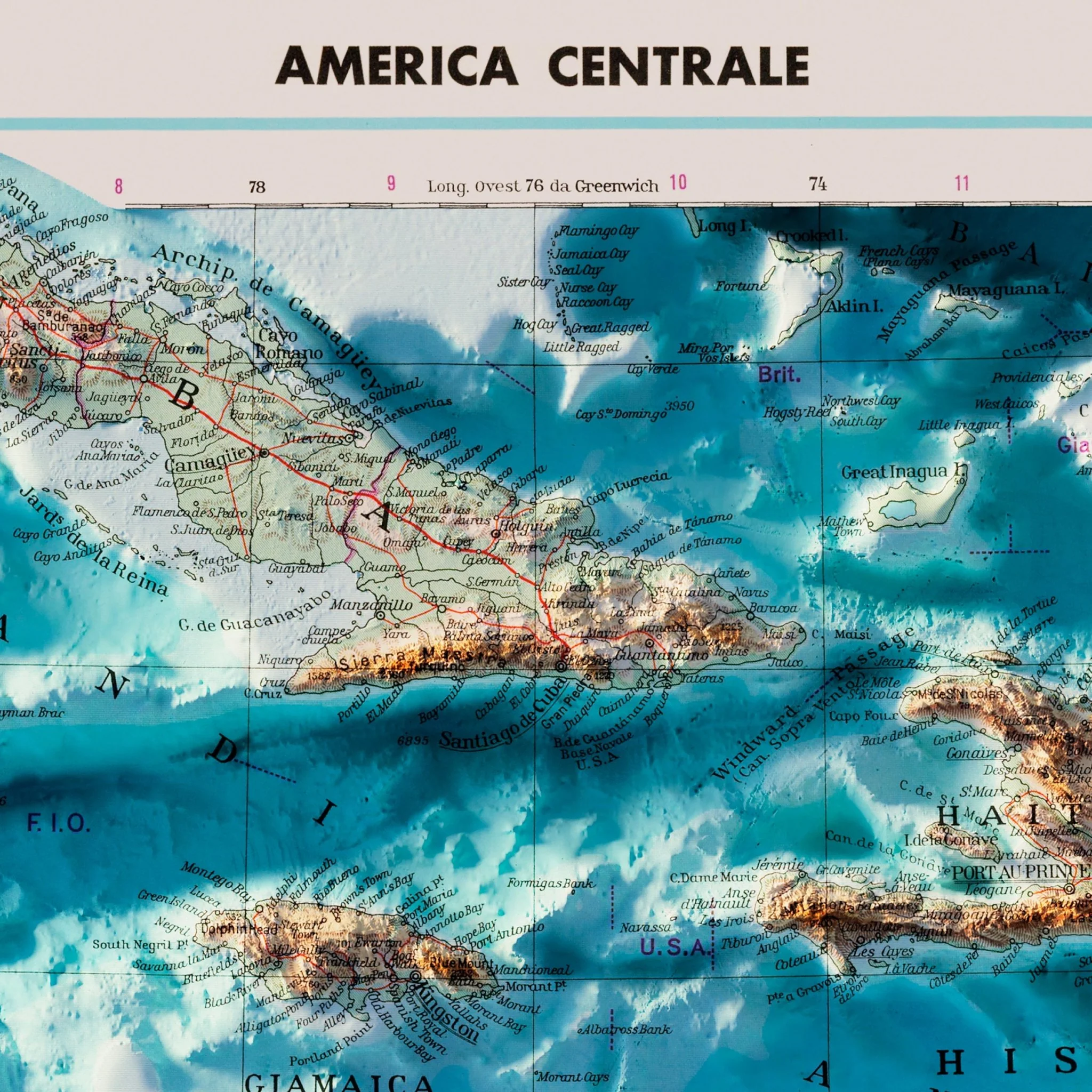
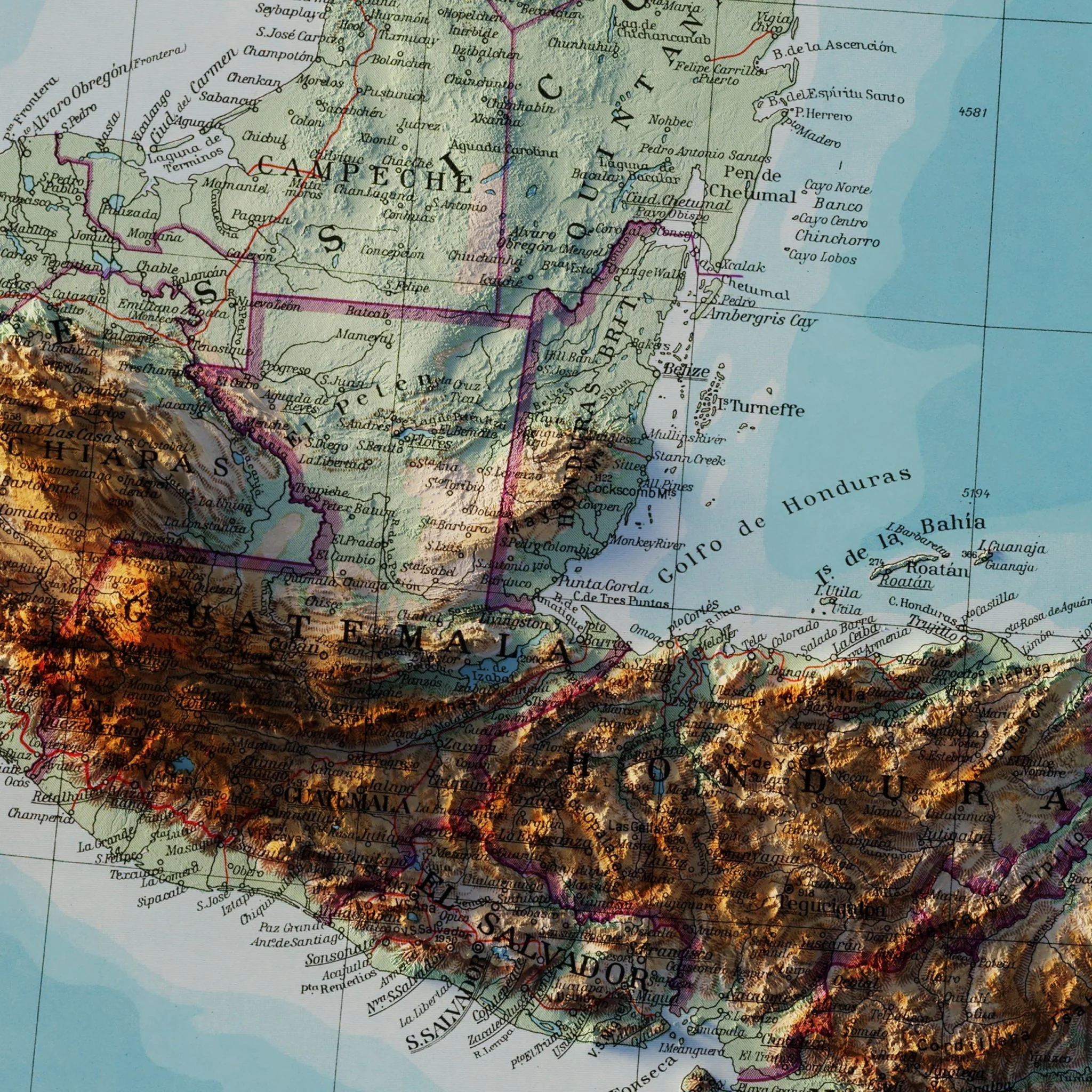
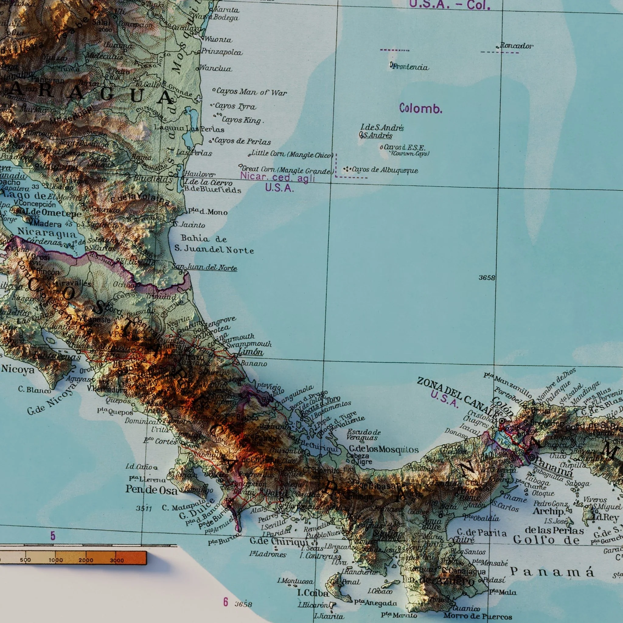
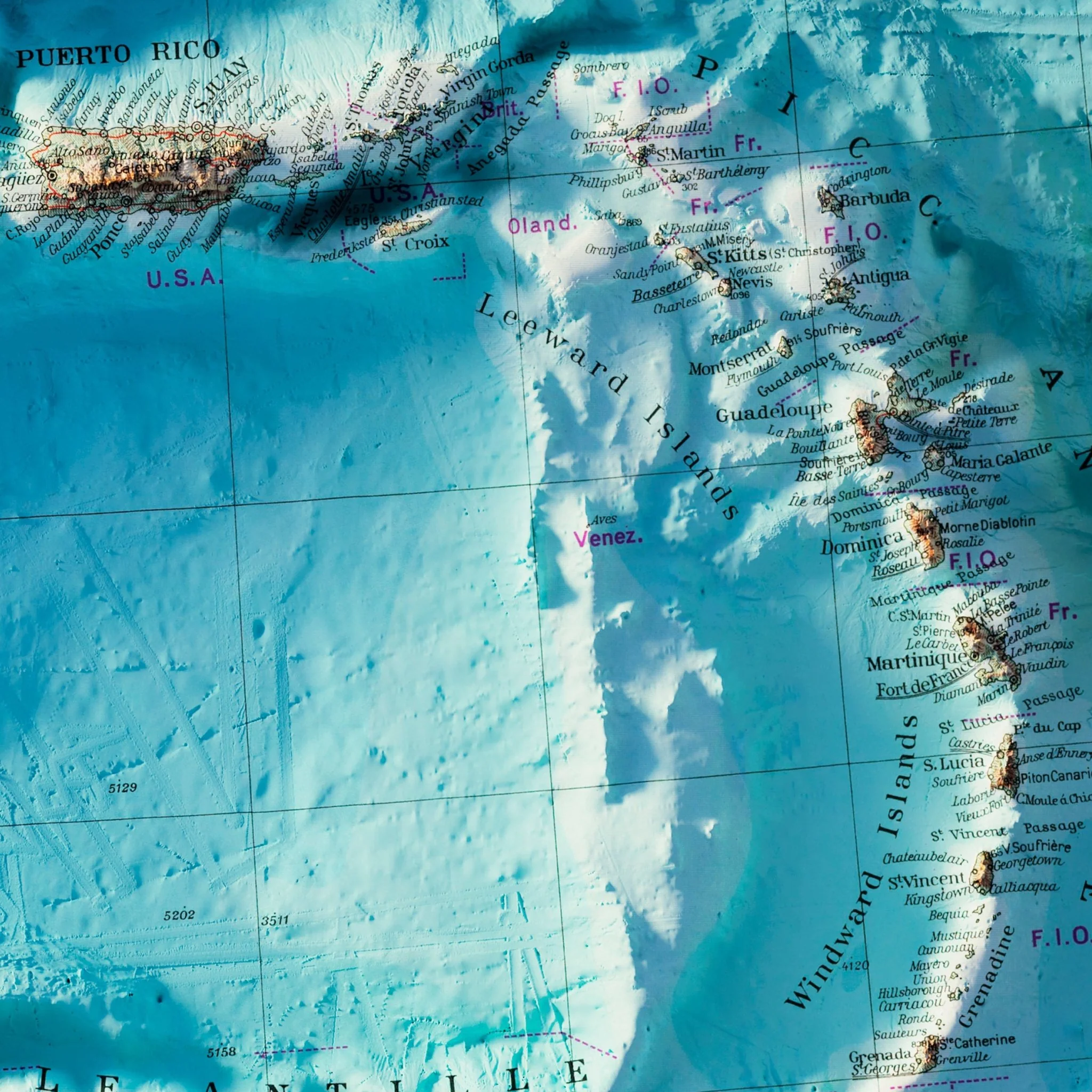
Central America 1952 Shaded Relief Map
We created this map with the illusion of 3D by applying Digital Elevation Data and meticulously adding shaded relief to the landscape of the original topologic 1952 Central America map. The shading is printed on the paper and not a result of the map protruding from the surface.
Bathymetry - the added terrain under sea level was created with data derived from Sonar imaging. Due to the inherent limitations of the data collection process, there are some areas that lack complete data resulting in lines and errors appearing on the Seafloor. These errors are part of the original data and not something we are able to manipulate or fix.

Please Note: Text on the map can be difficult to read due to the small font size and the age of the map. In areas where the relief shading covers the text, the underlying text is not legible. We suggest the largest size map for better details though the text may still be covered in the darker areas.
Available with or without Bathymetry data.
Product Information
Product Information
Shipping & Returns
Shipping & Returns

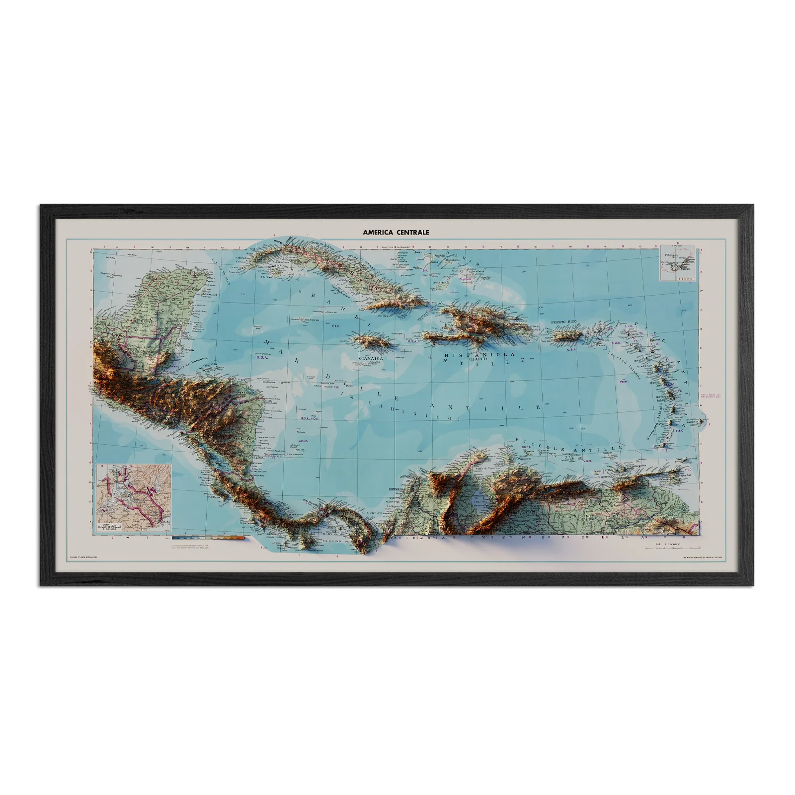
Central America 1952 Shaded Relief Map
Central America 1952 Shaded Relief Map
We created this map with the illusion of 3D by applying Digital Elevation Data and meticulously adding shaded relief to the landscape of the original topologic 1952 Central America map. The shading is printed on the paper and not a result of the map protruding from the surface.
Bathymetry - the added terrain under sea level was created with data derived from Sonar imaging. Due to the inherent limitations of the data collection process, there are some areas that lack complete data resulting in lines and errors appearing on the Seafloor. These errors are part of the original data and not something we are able to manipulate or fix.
Please Note: Text on the map can be difficult to read due to the small font size and the age of the map. In areas where the relief shading covers the text, the underlying text is not legible. We suggest the largest size map for better details though the text may still be covered in the darker areas.
Available with or without Bathymetry data.
Original: $936.00
-70%$936.00
$280.80Product Information
Product Information
Shipping & Returns
Shipping & Returns
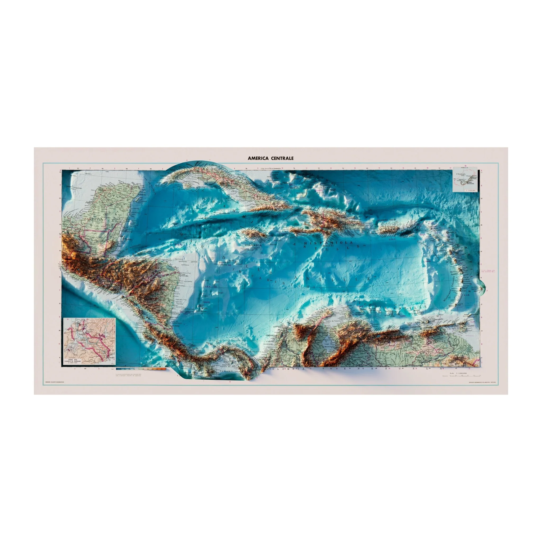
Description
We created this map with the illusion of 3D by applying Digital Elevation Data and meticulously adding shaded relief to the landscape of the original topologic 1952 Central America map. The shading is printed on the paper and not a result of the map protruding from the surface.
Bathymetry - the added terrain under sea level was created with data derived from Sonar imaging. Due to the inherent limitations of the data collection process, there are some areas that lack complete data resulting in lines and errors appearing on the Seafloor. These errors are part of the original data and not something we are able to manipulate or fix.
Please Note: Text on the map can be difficult to read due to the small font size and the age of the map. In areas where the relief shading covers the text, the underlying text is not legible. We suggest the largest size map for better details though the text may still be covered in the darker areas.
Available with or without Bathymetry data.